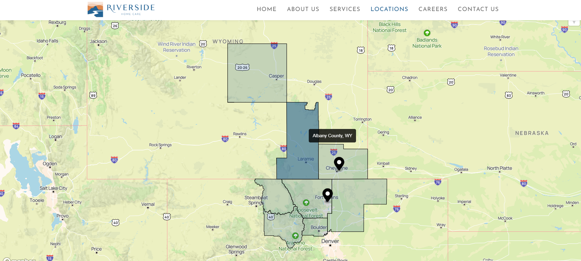
The web map developed was about displaying covered counties and office locations for Riverside Home Care. Counties and locations are dynamic and imported from ACF in WordPress.


 WP Interactive Map - USA Counties Covered - ACF
The web map developed was about displaying covered counties and office locations for Riverside Home Care. Counties and locations are dynamic and imported from ACF in WordPress.
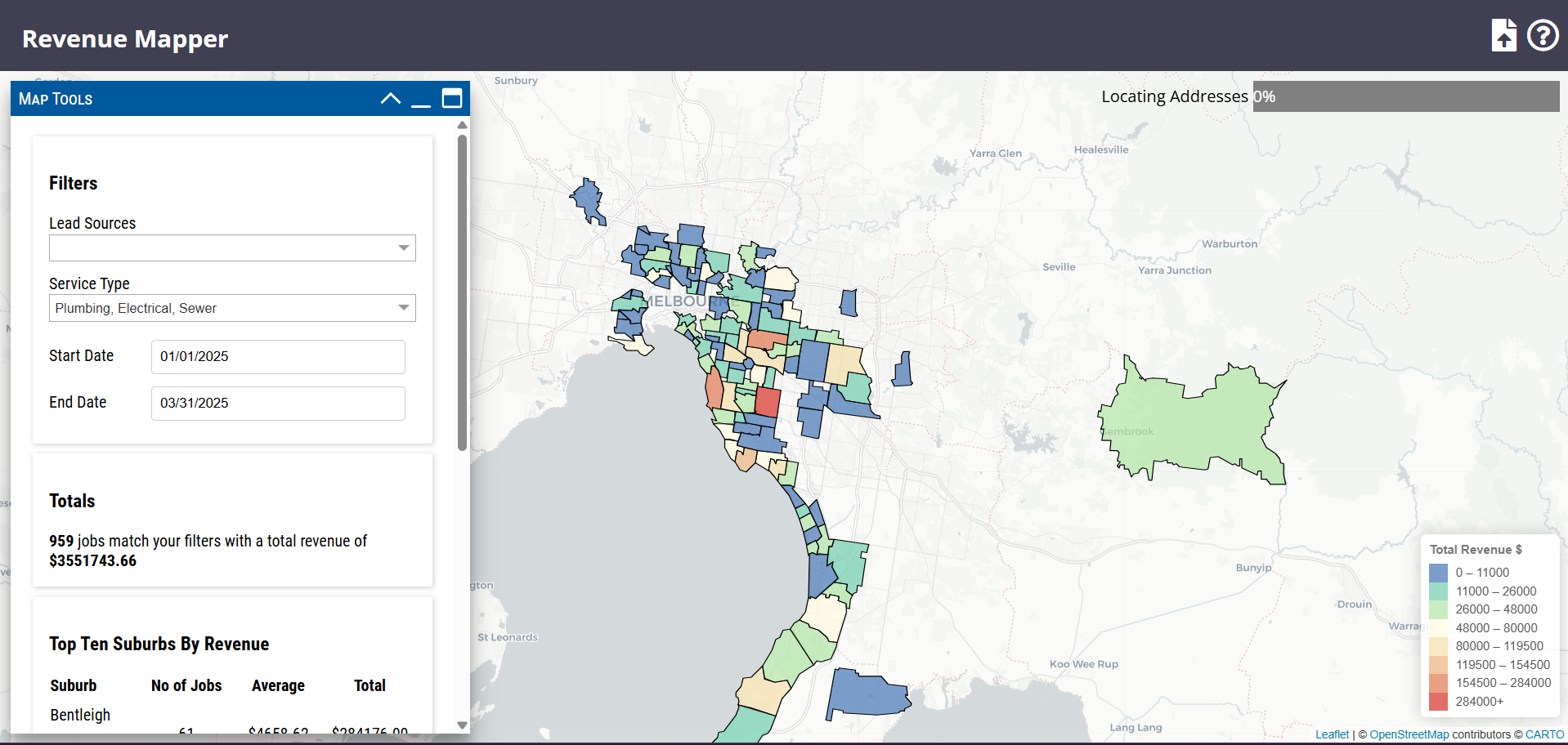 Interactive Web Map - Revenue by Suburb in Australia - Mapbox
- Import CSV including revenue reports by suburb in Australia- Displays an interactive heatmap with filters.- Geocoding Addresses.
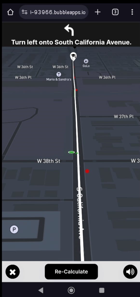 Bubble.io - Mobile App - Driving Instructions & Historical Crash Data
I developed a web map application using Mapbox to display historical crash data across the USA, providing real-time warnings to users when they approach crash-prone locations.The project integrates the Mapbox Directions API for driving directions with voice instructions, ensuring seamless navigation. Built on Bubble.io, the app is optimized for both desktop and mobile users, enhancing […]
 GIS data extraction and research of fire-damaged homes
GIS data extraction and research of fire-damaged homes in LA, USA. Real estate data extraction of more than 10,000 fire damaged homes (from RentCast): - Homeowner information - Most recent property valuation etc..
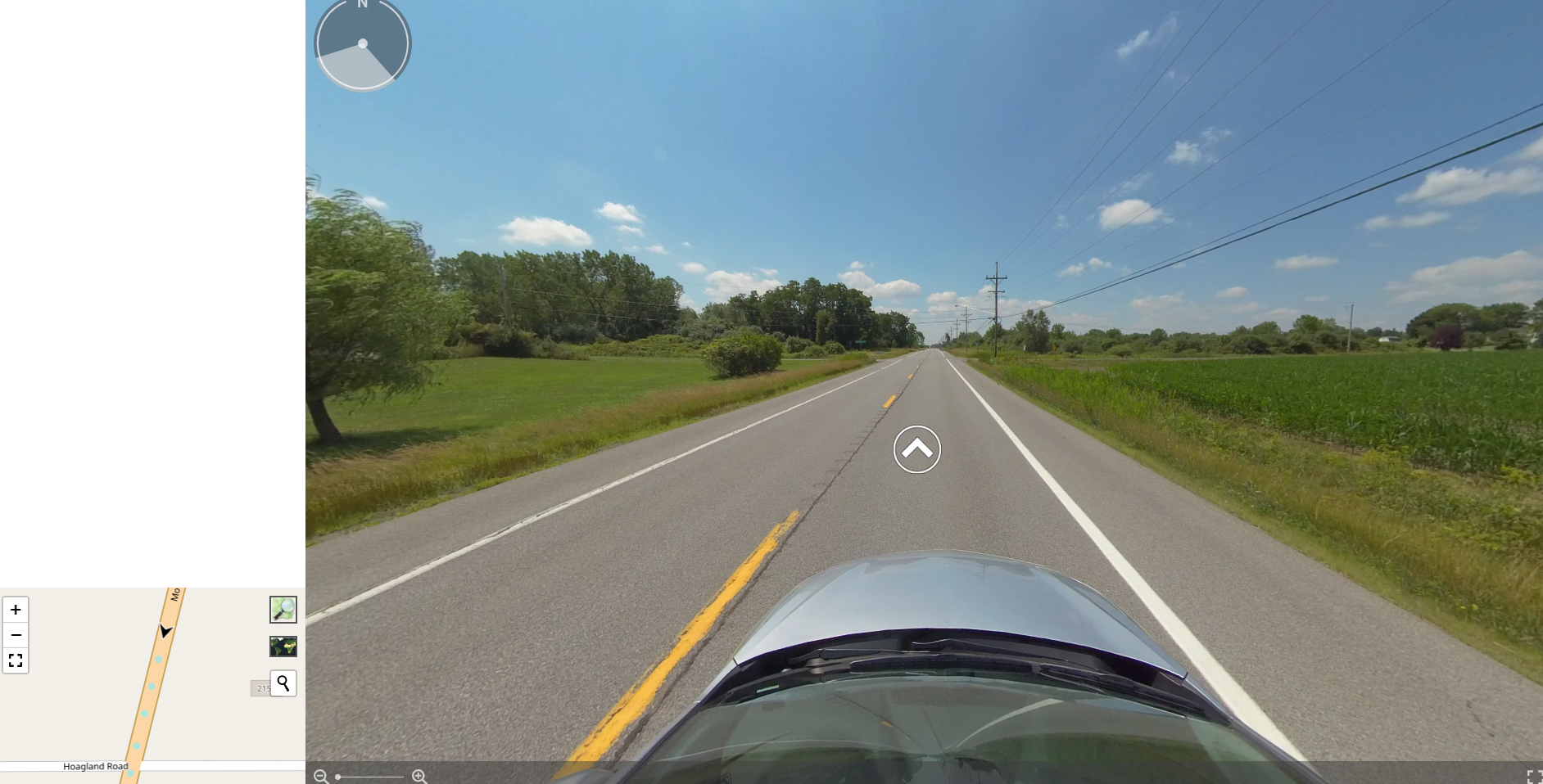 360° Street View Tour
Client needed Virtual Street View Tour image files to be displayed as 360 panorama. Also needed navigation arrows on street as on Google Street View. All this had to be connected to a Leaflet map.- Leaflet JS (for interactive web map)- Photo Sphere Viewer (for 360° panorama view)- Turf JS (for distance and bearing calculations)- […]
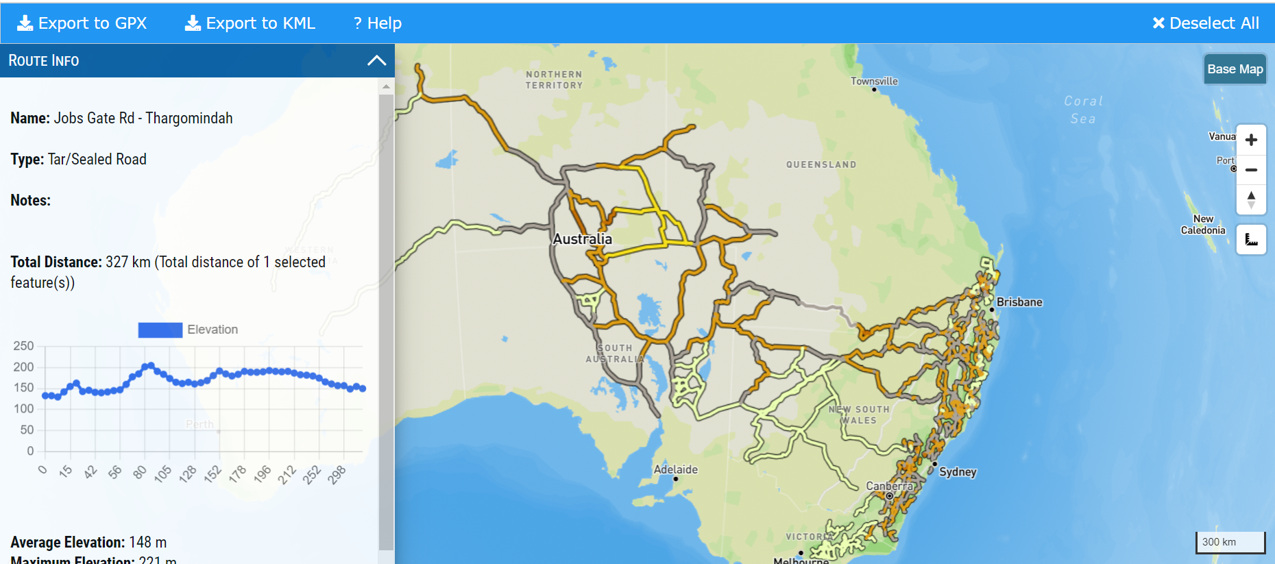 WP - Interactive Web Map - Roads and Tracks for Motorcycle Adventures
Interactive web map showing tracks & routes for motorcycle riding in Australia. Roads can be downloaded in KML & GPX.
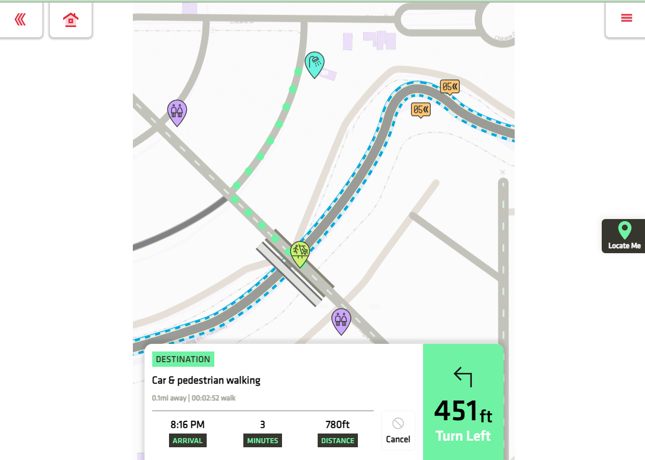 Bubble.io Interactive Routing App
Added custom Routing and Directions calculations using geojson-path-finder library in a Bubble.io app. - Bubble.io Plugin Development. - MapboxGL JS - TurfJS
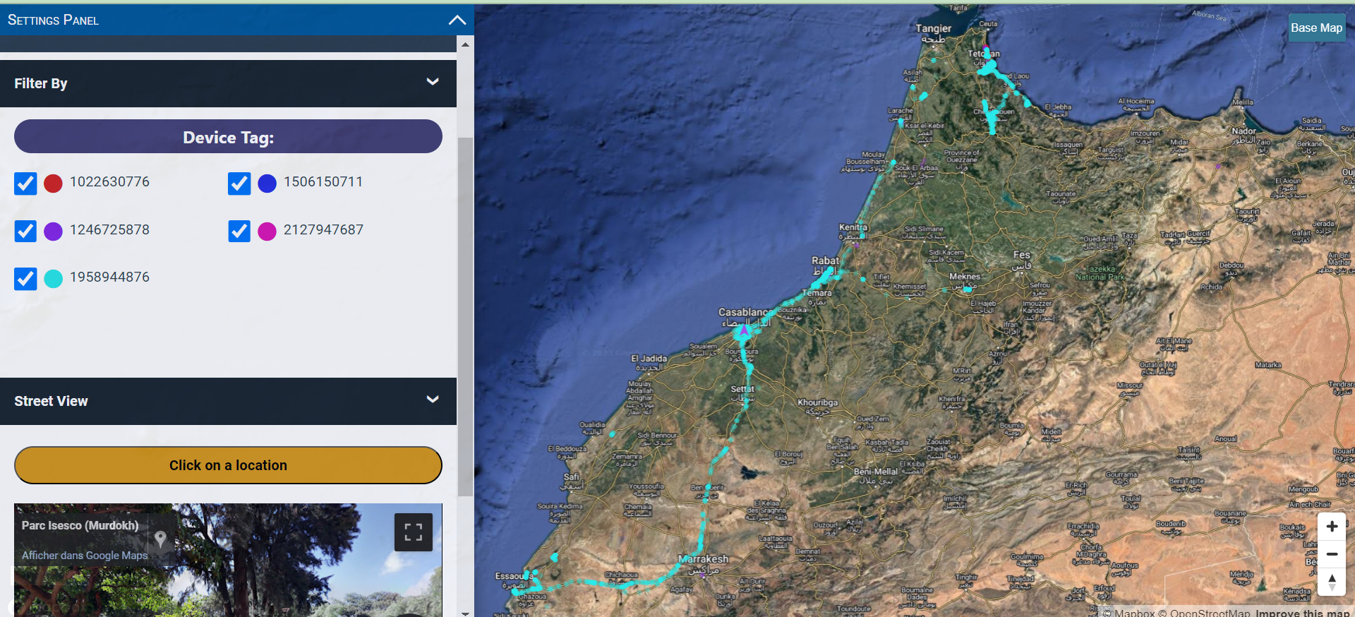 Google Location Data Reader
Web interactive map allowing Google location data import (JSON). Each device is plotted with different color. Filtering by date & time & device tag. - Google Street View API.
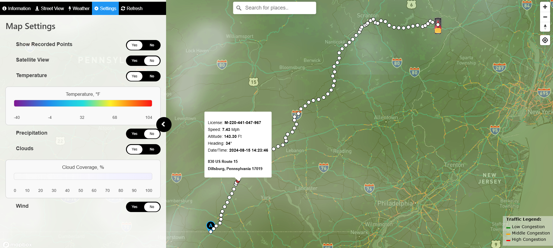 Driver Tracking Solution - Web Map -
I developed a web map solution using Mapbox, JavaScript, and PHP for real-time truck driver tracking. The system includes dynamic weather updates, traffic congestion overlays, and vehicle data such as speed, altitude, and route history.Users can customize settings like satellite view, weather conditions, and recorded points visibility, all integrated with Google Street View for enhanced […]