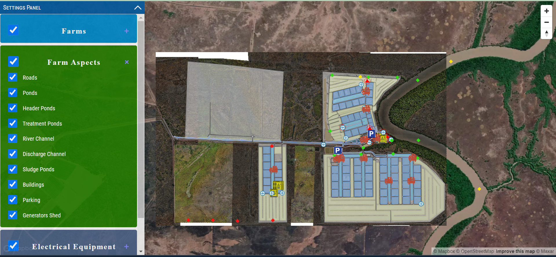
Georeferencing Raster image and plotting it into an interactive web map + Vector tiles. - Filtering features.


 Web Map (Raster Georeferencing + Vector tiles)
Georeferencing Raster image and plotting it into an interactive web map + Vector tiles. - Filtering features.
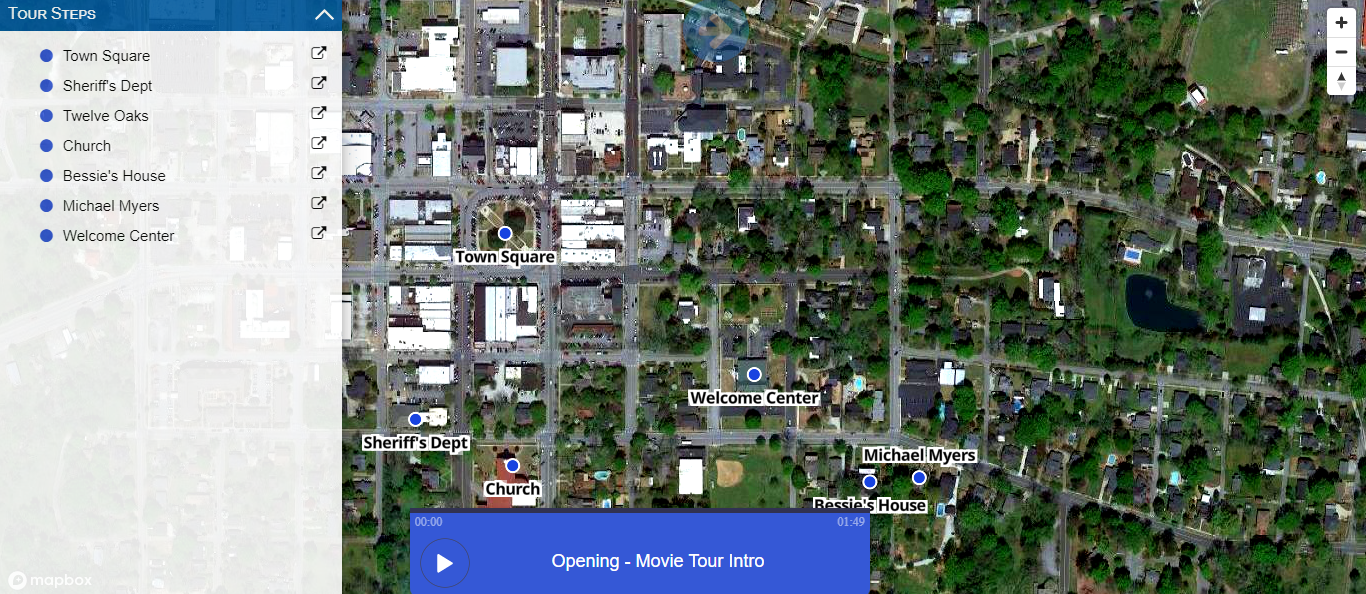 Virtual Tours (MapboxGl Js) with Audio
- Designed WordPress Website from PSD Mockup.- Different Tours, each tour has different stops and each stop plays assigned audio file.- Tours can be accessed only via subscription (for 24hrs or 48hrs).
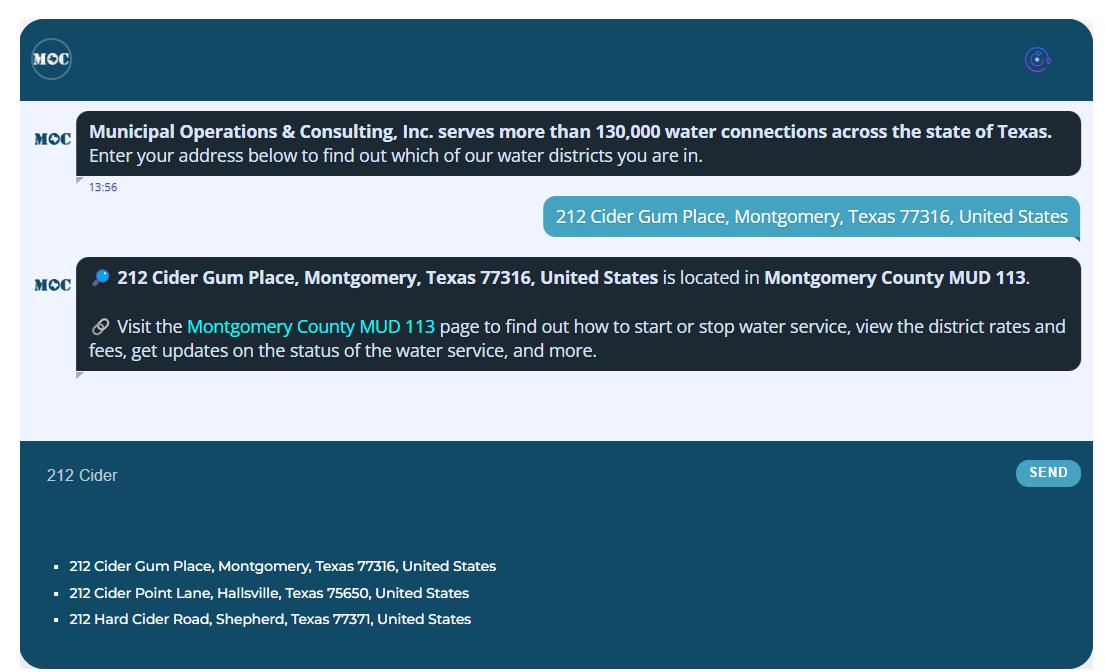 GIS Chatbot for WordPress
Developed a Chatbot for a WordPress website. It checks for the entered address if it's within some water districts of Texas, USA.
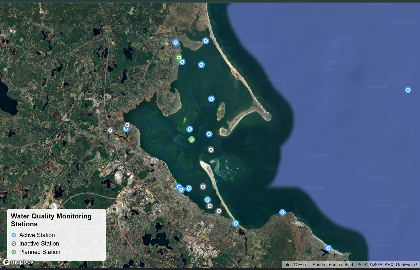 Water Quality Monitoring Stations Map
Created an interactive mapping application for visualizing water quality monitoring stations across Cape Cod Bay.Features include custom SVG markers with status-based color coding (active/inactive/planned), detailed popups with station information and parameters, satellite imagery basemap integration, and comprehensive legend.Displays real-time and historical water quality data from multiple organizations including CCS, Mass Bays NEP, and Cape Cod […]
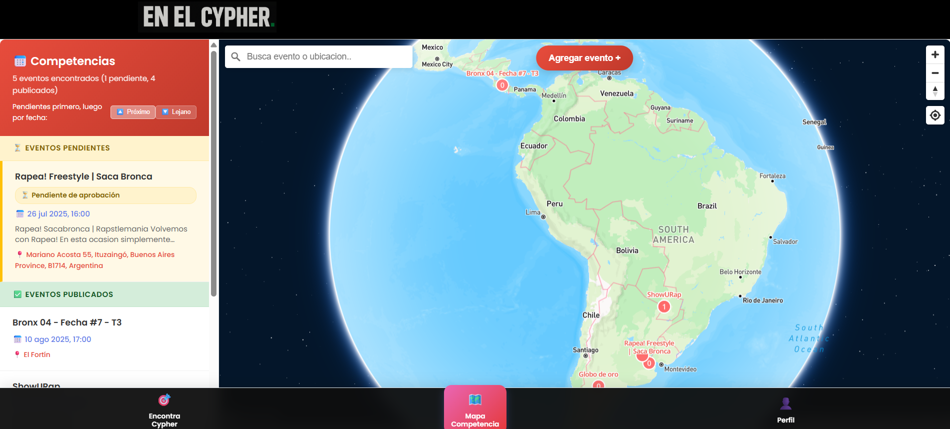 Interactive Map + Android App - ENELCYPHER - Freestyling Social Events
Developed a WordPress-based web application for the freestyle community across South America.The platform features an interactive map displaying freestyle events, complete user authentication, and profile management. Users can RSVP to events or create new ones by dropping pins and submitting details for admin approval. Additionally, built and published an Android app to Google Play Store […]
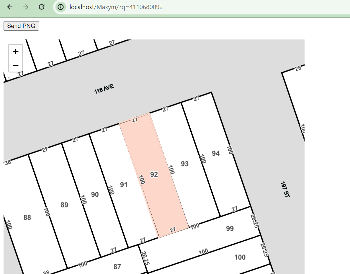 Interactive Property Information Mapping Solution
Developed an interactive property information mapping solution utilizing ArcGIS API, Mapbox GL JS, and Leaflet JS. The project involved creating a web-based map interface that displays property boundaries and highlights selected objects based on provided IDs. Key features included interactive layers with zoom-in/zoom-out functionality, a centered and highlighted object, and a "Generate Image" button that […]
 WP - Interactive Location Mapping & Filtering Tool
Built a comprehensive web app for mapping and analyzing location data with advanced filtering capabilities.Features include Mapbox integration with custom drawing tools (polygon, rectangle, circle), user geolocation with radius selection, category-based filtering with dynamic color coding, and real-time search/sort functionality.Includes automated geocoding for missing coordinates, WordPress API integration, Excel export functionality, and responsive design with […]
 Static Maps for Mail Pieces - More than 28k PDFs -
Mail pieces generation with Mapbox Static Image API & Python scripts