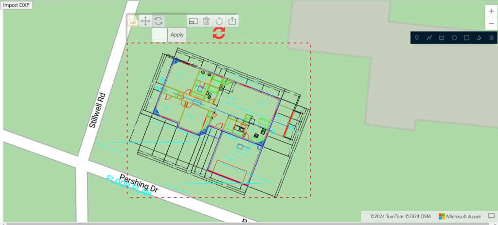
Imports DXF files and converts them to GEOJSON format. The application includes features for rotating, scaling, and manipulating the imported data, providing users with a dynamic and user-friendly mapping experience. Leveraging technologies like Azure Maps, and custom back-end solutions. This solution is ideal for professionals needing precise control and visualization of architectural and engineering drawings on web platforms.