Interactive web map for Pensacola Parking website + Website design using Elementor


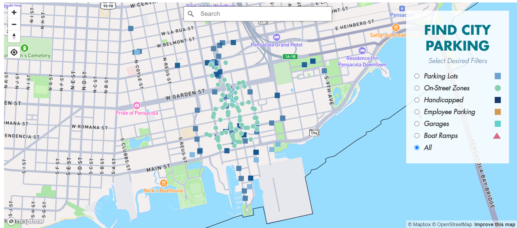 WP- Web Interactive Map - Parking Lots in Pensacola (Florida, USA)
Interactive web map for Pensacola Parking website + Website design using Elementor
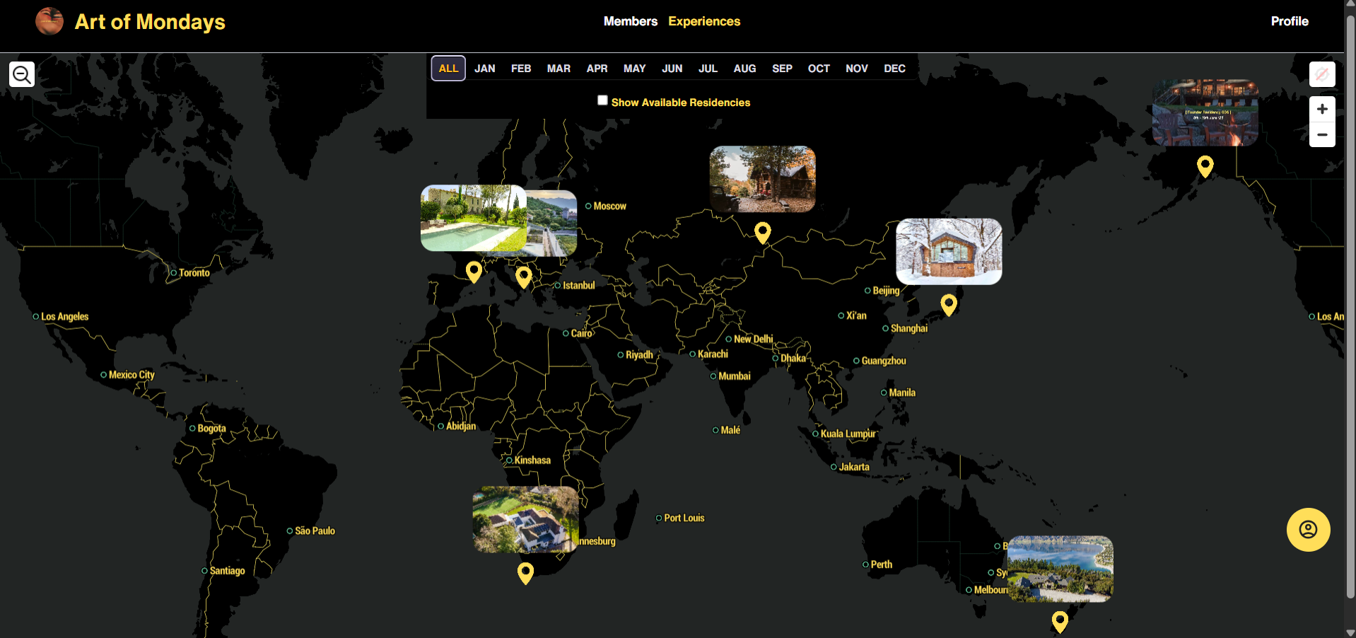 Interactive Global Idea-Sharing Platform: Location-Based Social Map
Developed an interactive web map application connecting users worldwide through location-based sharing. Integrated Mapbox GL JS with Bubble.io to create a platform where users can register, have their location automatically saved and displayed on a global map, and share ideas.Features include secure authentication, real-time geolocation mapping, comprehensive profile management (photos, bio, Instagram links), and an […]
 High Resolution 3D Printable Global Terrain Map from DEM Data
Created a detailed 3D-printable global terrain map using Digital Elevation Model (DEM) data. This project showcases expertise in geospatial data processing and 3D modeling workflows.
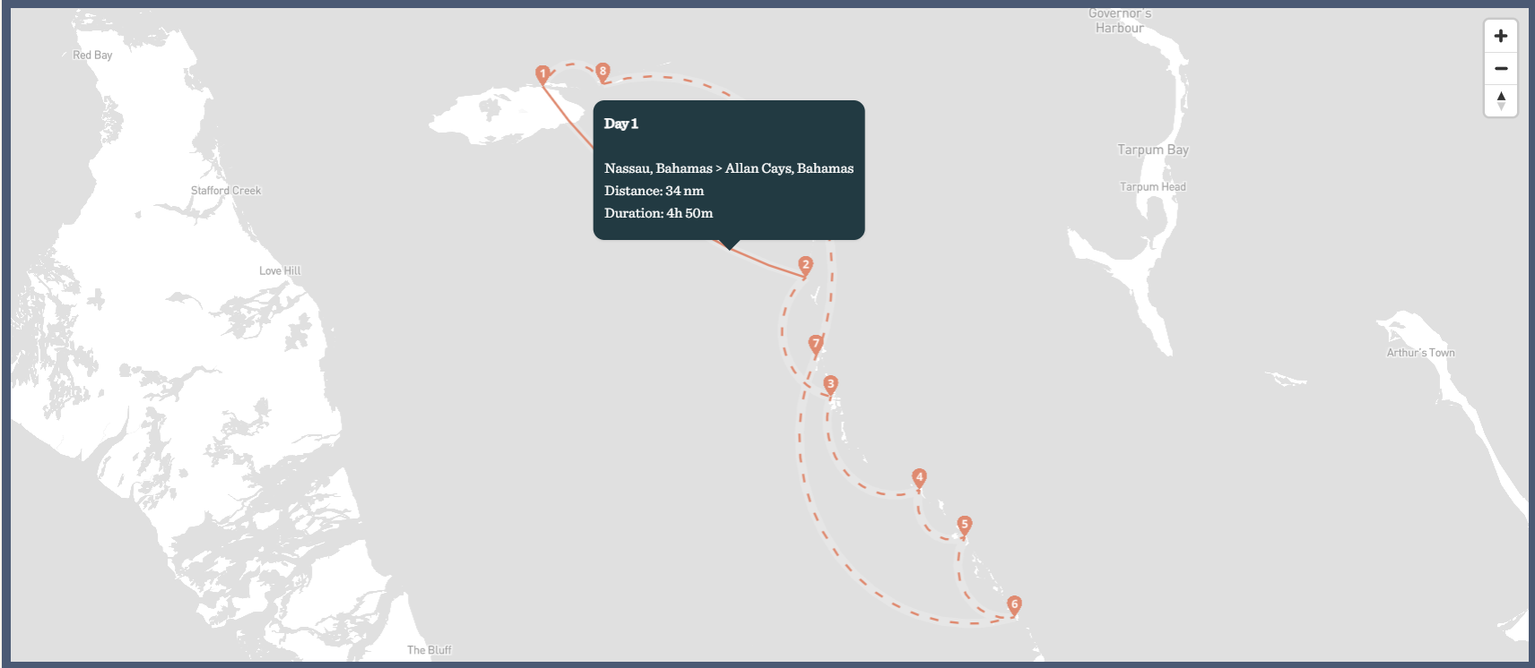 Interactive Trip Maps - Itineraries - MapboxGL JS
Developed 32 interactive Mapbox GL JS maps for WordPress showcasing island travel routes with animated ant path effects.Users can click route lines to view distance and travel duration between locations. Integrated with Advanced Custom Fields (ACF) for easy content management, allowing non-technical updates to routes and waypoints.Implemented smooth line animations, GeoJSON route data handling, and […]
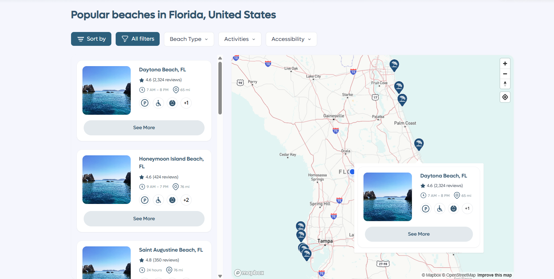 TALL Stack - Beach Discovery Platform
Built a full-stack beach discovery platform using Tall Stack (Tailwind, Alpine.js, Laravel, Livewire).Developed automated Google Places API scrapers to collect 500+ US beaches, nearby restaurants, parking locations, and calculated optimal beach entrances. Features include dynamic landing page, interactive beach cards, detailed beach profiles with live weather/water temperature data, restaurant recommendations, and user review system. Implemented […]
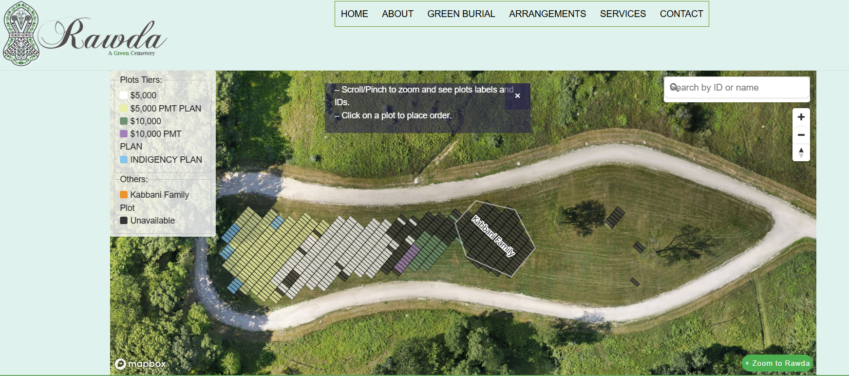 Interactive Web Map for Cemetery plots in WordPress
The client wanted to show new plots for a cemetery on his website. I suggested to do it with Mapbox, in order to get a realistic user experience in selecting/interacting with plots, with a Google Satellite view. The user can click on a plot and see if it's available to buy, if so he gets […]
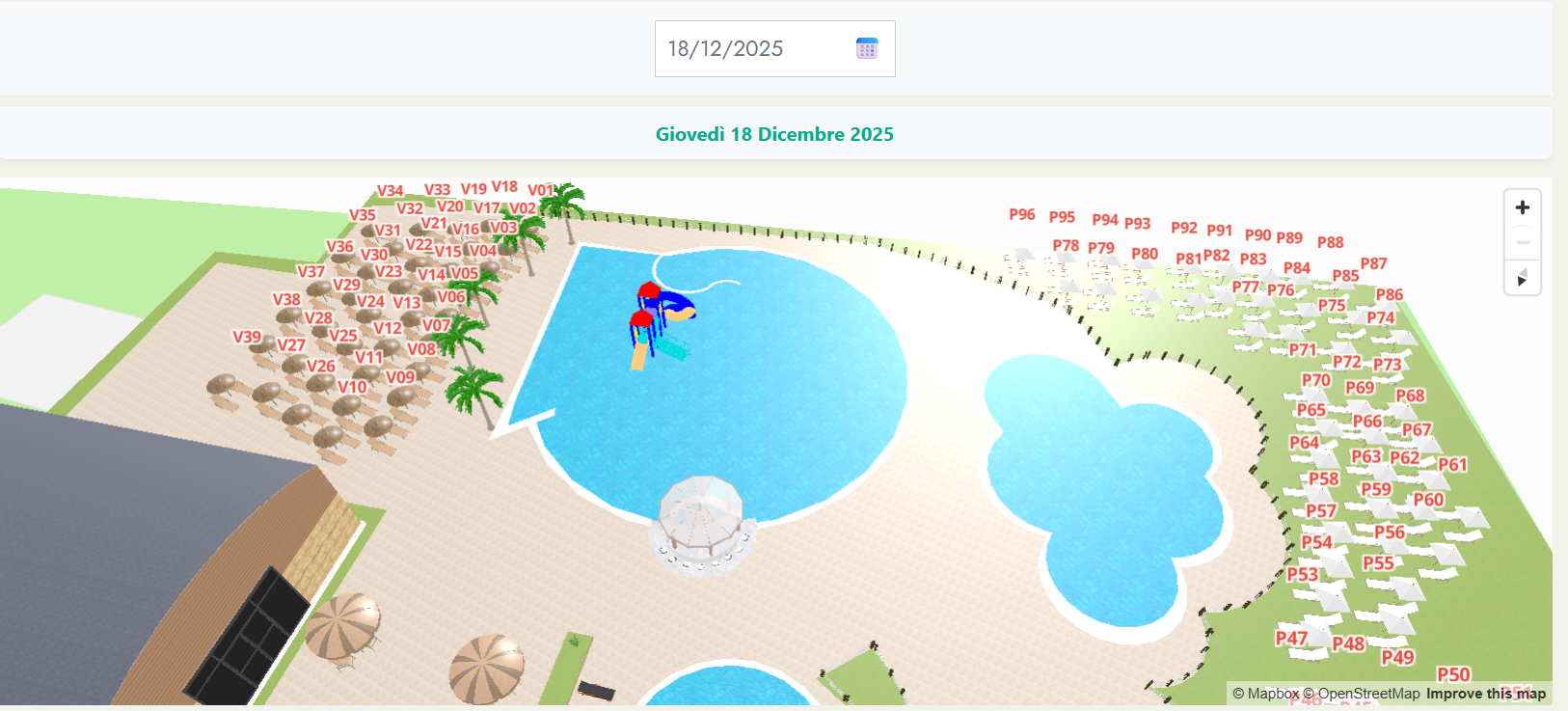 Interactive 3D Pool Map: Custom WordPress Booking Solution
Developed a custom 3D interactive pool booking system for WordPress using MapboxGL JS and Threebox, seamlessly integrated with YITH Booking Plugin.Created detailed 3D models of chairs and umbrellas in SketchUp and implemented them into an immersive web map experience where users can select dates and visualize real-time availability.The solution transforms traditional booking into an engaging […]
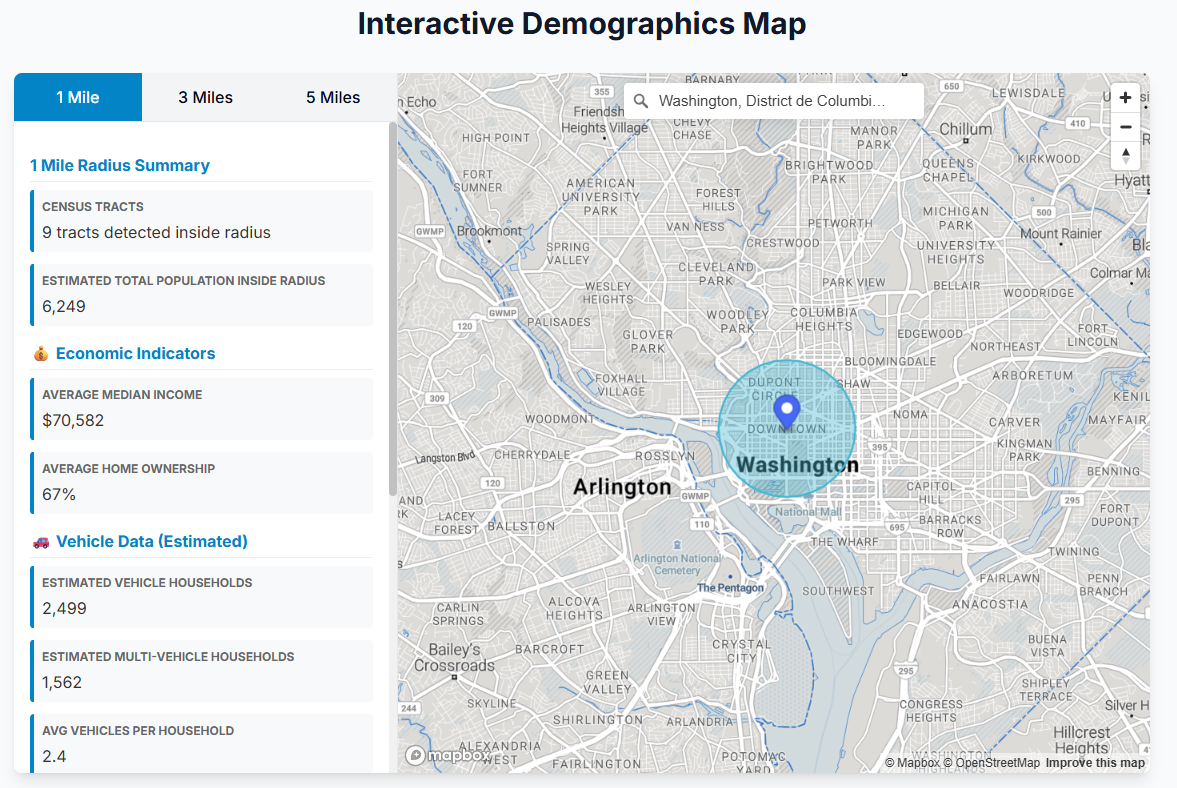 US Census Tracts - Demographics & Traffic Data - Interactive Web Map
This web map allows users to search for an address, then displays the average census tracts demographic & traffic data inside 3 radiuses (1 mile, 3 miles and 5 miles).Data are fetched directly from the Census Bureau API
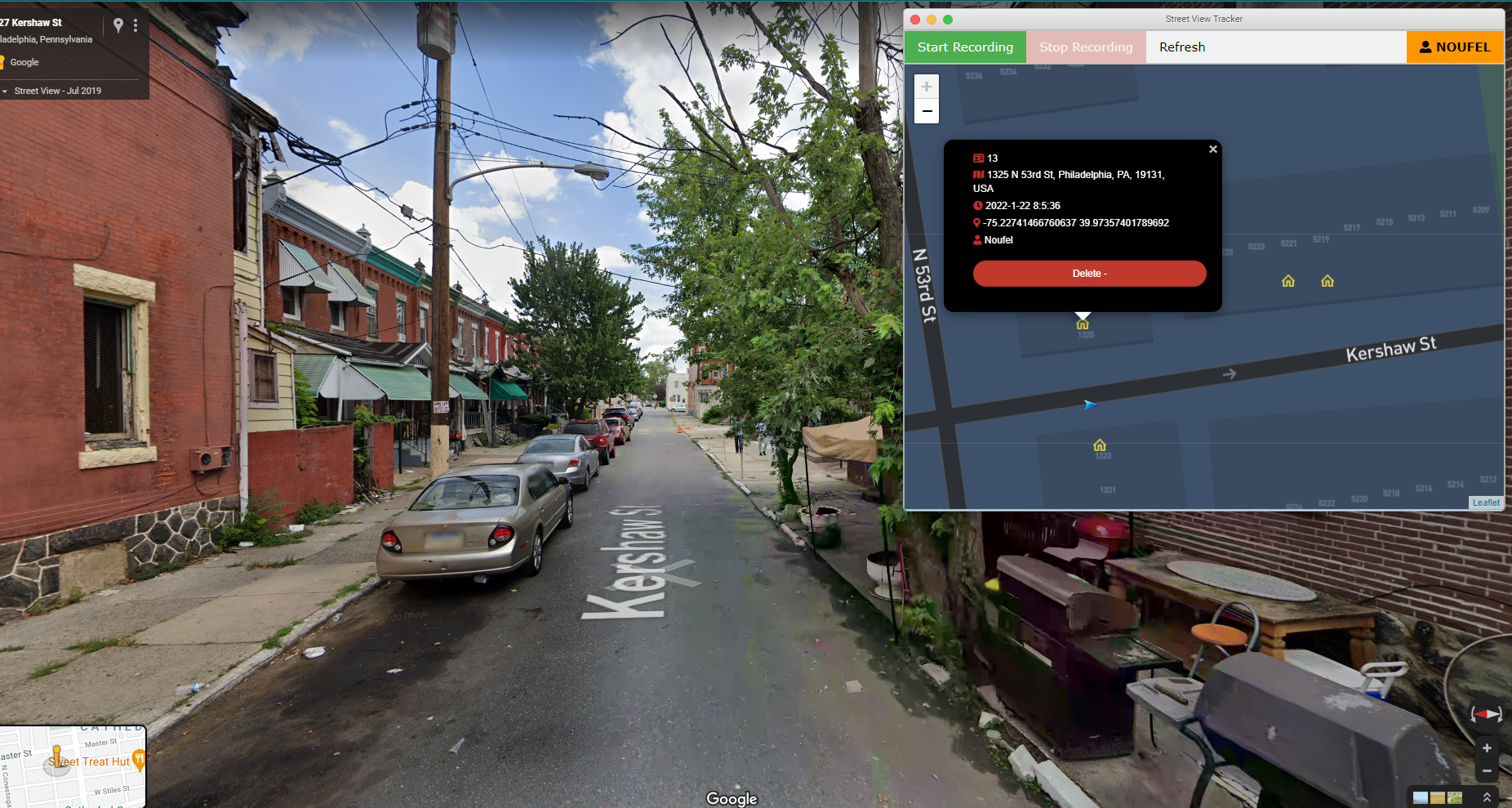 Google Street View Tracker
Developped a Chrome extension that allows to track and record taken routes on Google Street View + allows to add buildings by a simple right-click on the map.
 Interactive Map with Search feature
Client wanted an interactive map integration, showing products price and pan/zoom to display available items.