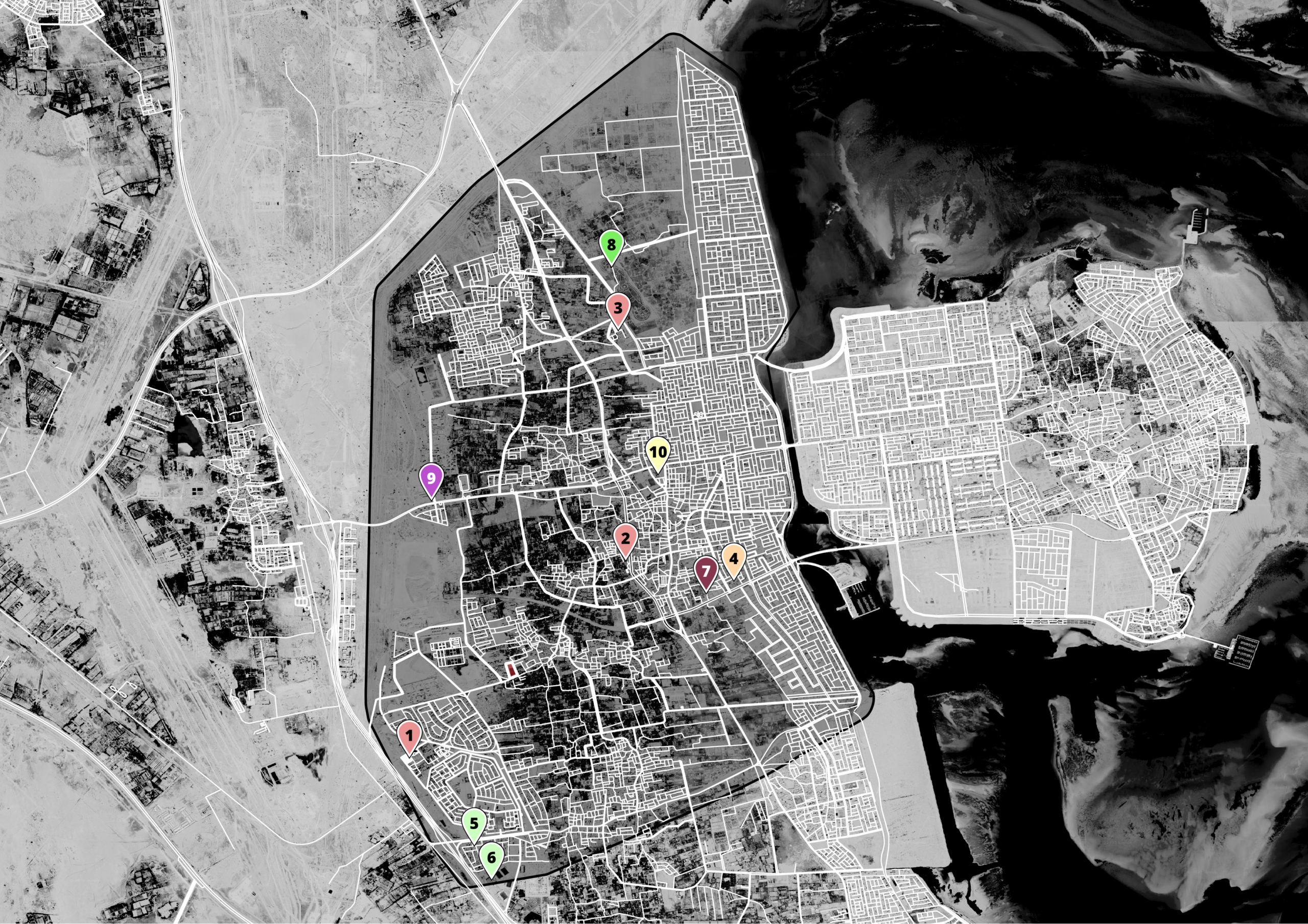
Web interactive map allowing Google location data import (JSON). Each device is plotted with different color. Filtering by date & time & device tag. - Google Street View API.


 Google Location Data Reader
Web interactive map allowing Google location data import (JSON). Each device is plotted with different color. Filtering by date & time & device tag. - Google Street View API.
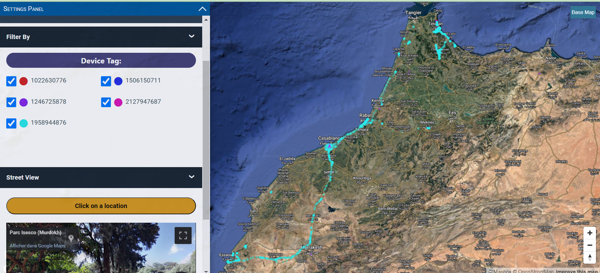
 Driver Tracking Solution - Web Map -
I developed a web map solution using Mapbox, JavaScript, and PHP for real-time truck driver tracking. The system includes dynamic weather updates, traffic congestion overlays, and vehicle data such as speed, altitude, and route history.Users can customize settings like satellite view, weather conditions, and recorded points visibility, all integrated with Google Street View for enhanced […]
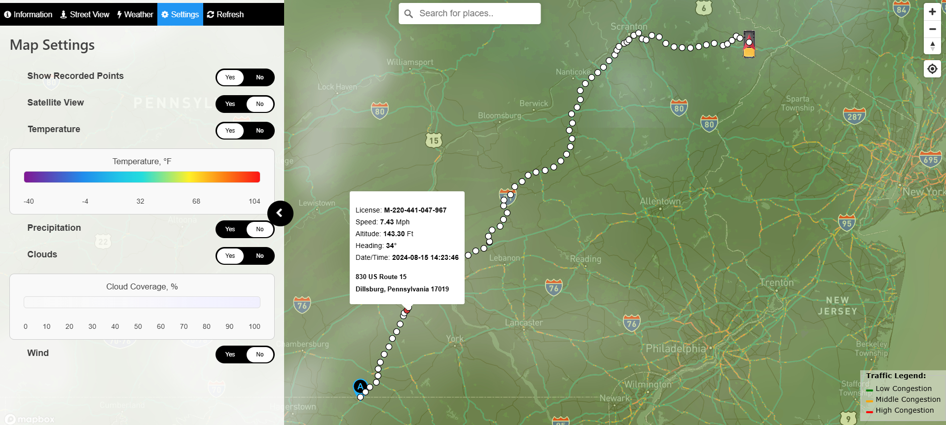
 WP Interactive Web Map - Dealer Locator
Built a responsive web app with Mapbox integration for finding authorized dealers across USA/Canada.Features include dynamic product filtering (3 categories), Google Sheets API integration, mobile-optimized interface with dropdowns, and interactive map with hover effects.Users can click states/provinces to view dealer listings with contact info and product badges.Responsive design adapts from desktop map view to mobile […]
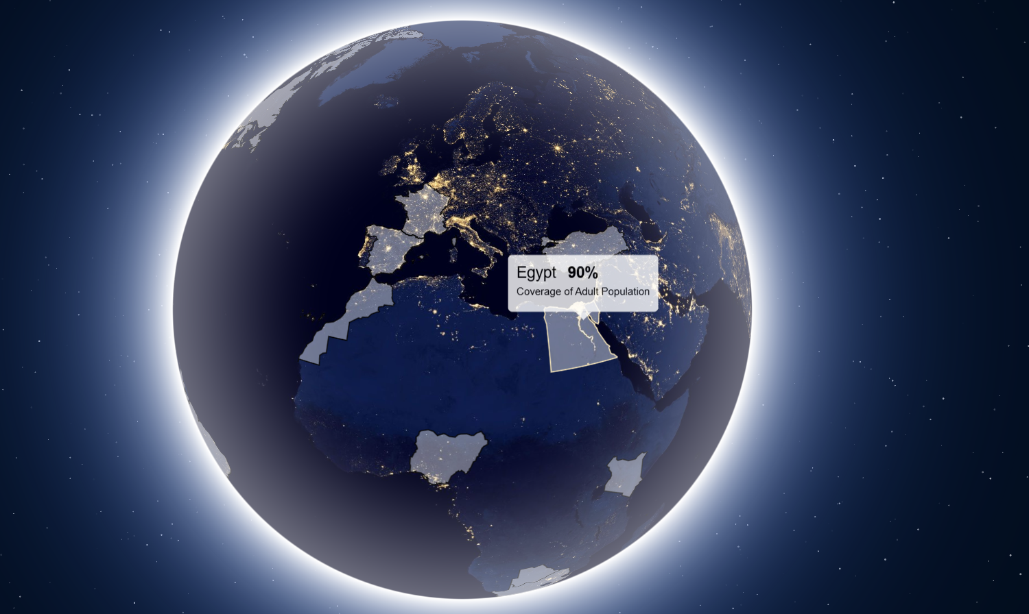 Interactive Globe Web Map - MapboxGL JS -
The web map is connected to a Google Sheet including all data for each country.
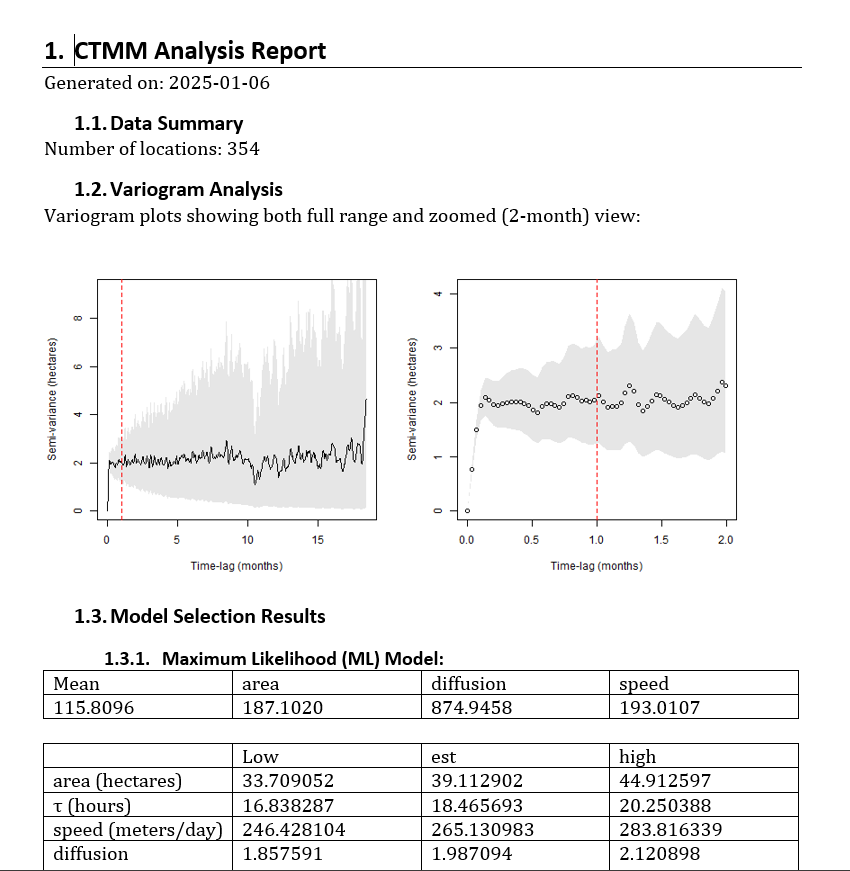 GIS Analysis - Auto Kernel Density Estimation - Home Range Area Est.
GIS Analysis - Autocorrelated Kernel Density Estimation - Home Range Area Estimation.
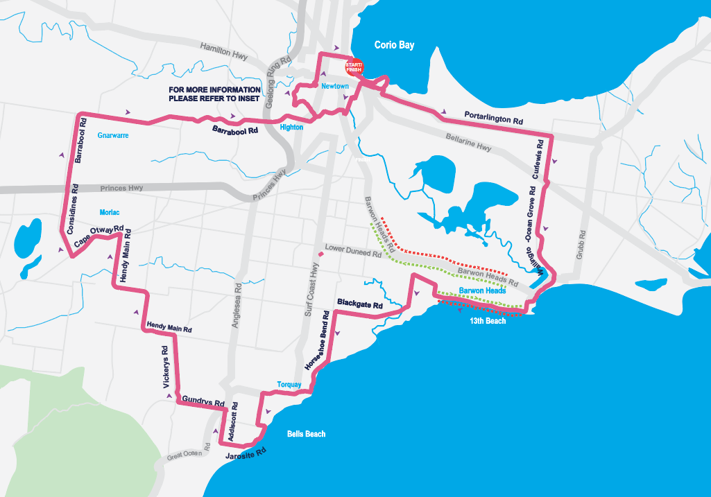 Course Map - Printable - Adobe Illustrator
Course maps creation & design on both QGIS & Adobe Illustrator
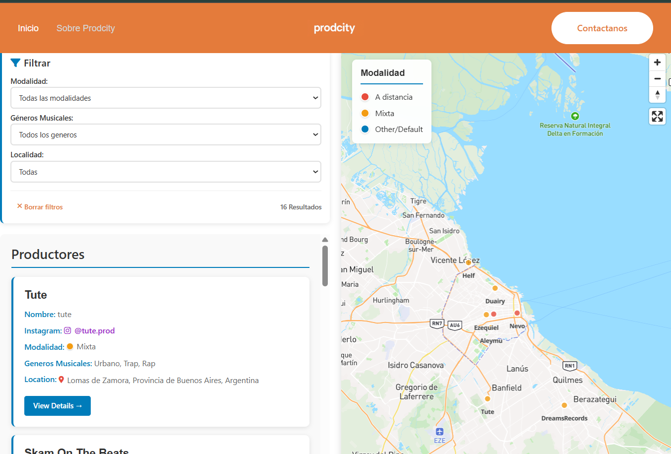 ProdCity WP - Interactive Web Map - Music Producer Directory
Developed a comprehensive WordPress solution featuring an interactive Mapbox-powered map with real-time filtering capabilities for a music producer directory.The project includes a responsive dual-panel interface with dynamic search filters, custom post type integration, and privacy-enhanced location display.
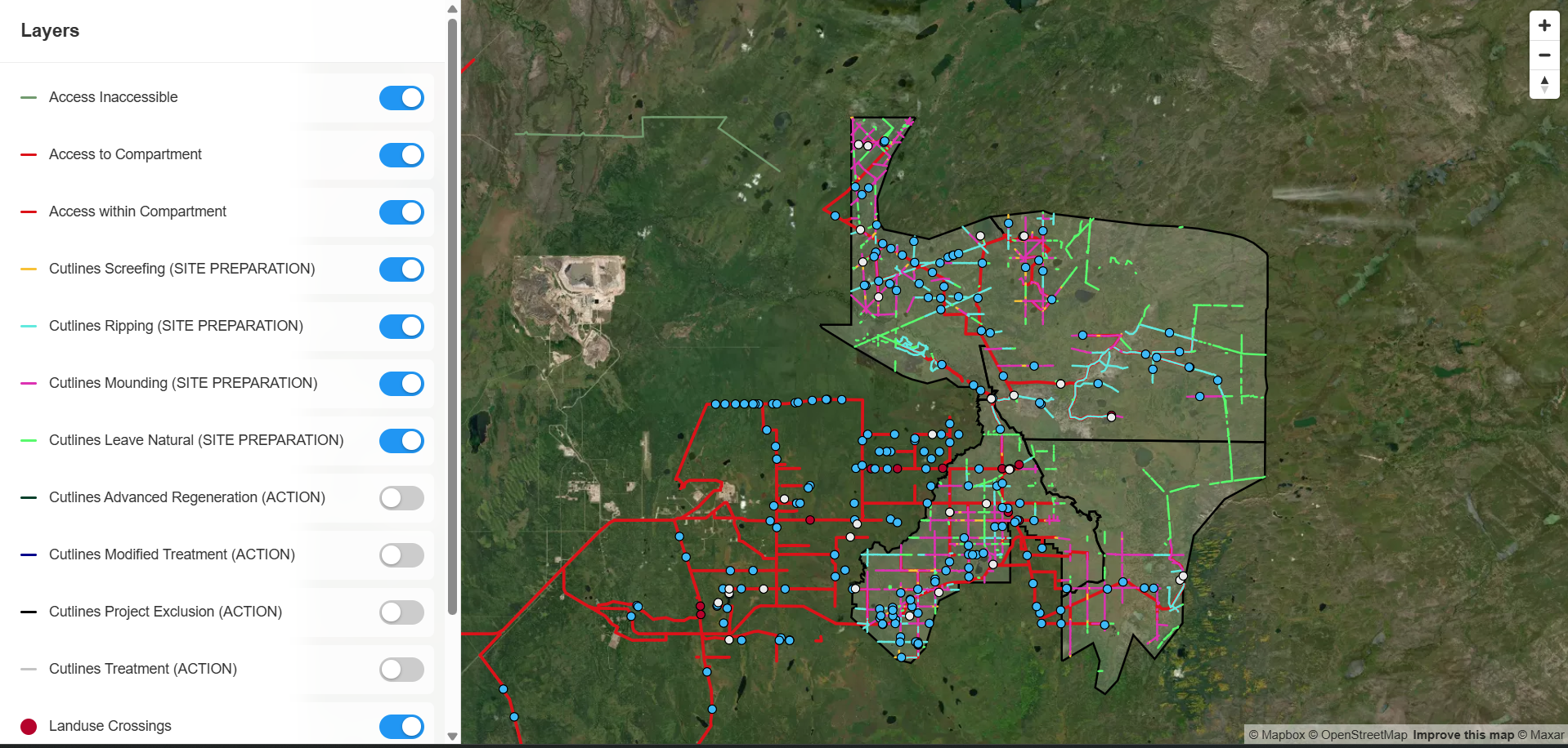 QGIS Analysis - Interactive Web Map - MapboxGL JS
- Processed pipelines width/length with QGIS. - Interactive Web Map development with MapboxGL JS.
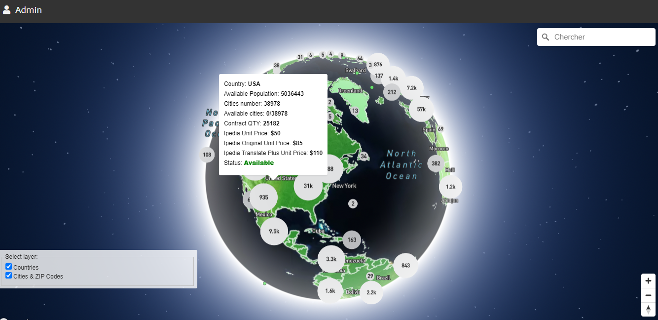 Interactive Web Map for Countries/Cities Reservation for a project
The Client wanted an interactive web map where eventual buyers can make areas reservation for their project. They could select a whole country or city and make their reservation through a form which will send info to the admin. When an area is reserved, it's shown as HOLD with orange color, once it's sold it's […]